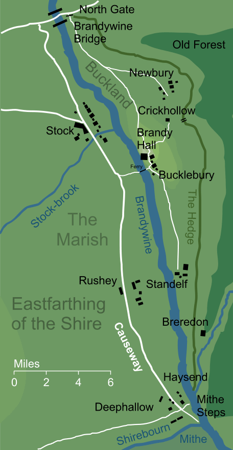
The roadway that ran north to south through the Marish beside the river Brandywine. This boggy region of the Shire's Eastfarthing was unsuitable for a typical road or track, and so a raised causeway was constructed through the fenlands. Its southern extent was the landing at Mithe, where the Shirebourn flowed into the Brandywine. From there it ran northwards through the village of Rushey and on at least as far as Stock (the course of the road continued northwards to the Brandywine Bridge, and it appears to have continued as a causeway as far as its meeting with the East Road).1
The Causeway of the Shire is not to be confused with another road, also named 'the Causeway', that ran between Osgiliath on Anduin and the Wall of the Pelennor. Though the principle was the same - to provide a dry path through marshy ground - that Causeway lay far away to the south of the Shire in the land of Gondor.
Notes
1 |
As Frodo and his companions journeyed eastward from Hobbiton during the first phase of their journey from the Shire, Frodo planned to walk across country and to '...strike the causeway from the Bridge above Stock' (The Fellowship of the Ring I 4, A Short Cut to Mushrooms). This seems to imply that the Causeway ran all the way northward through Stock and on to meet the East Road, just to the westward of the Brandywine Bridge. |
Indexes:
About this entry:
- Updated 16 March 2014
- This entry is complete
For acknowledgements and references, see the Disclaimer & Bibliography page.
Original content © copyright Mark Fisher 2013-2014. All rights reserved. For conditions of reuse, see the Site FAQ.
Website services kindly sponsored by Axiom Discovery aptitude and skill testing.
Personality is one part of understanding a candidate's suitability for a role, but aptitude can also be crucial.