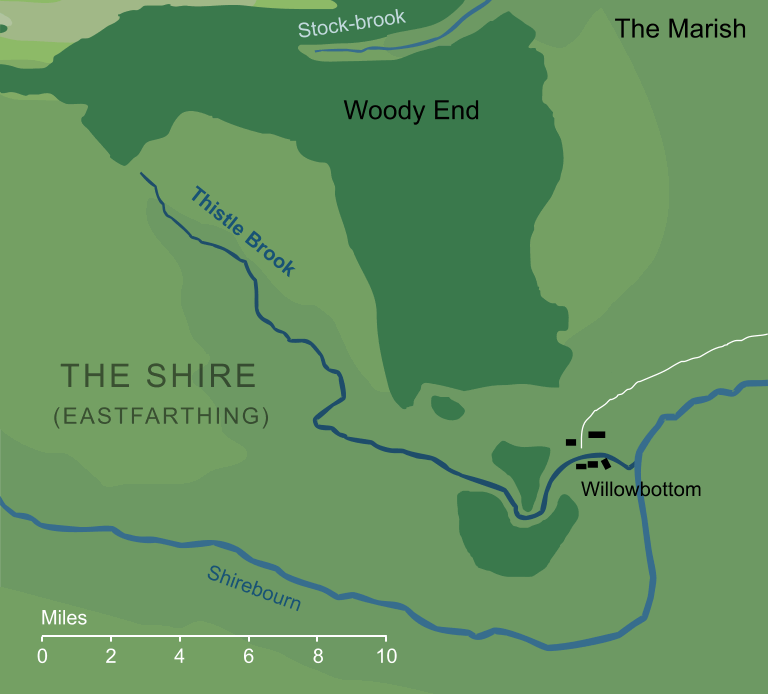
A small stream that ran through the southern parts of the Shire's Eastfarthing. It had its source in the wooded heights of the eastern Green Hill Country, from which it flowed southeastward for about twenty miles until it ran past the southern parts of Woody End. There it looped eastward, and passed through the village of Willowbottom before emptying into the wider river known as the Shirebourn.
Thistle Brook is not described in any detail, but from its name we can presume that thistles grew along its course in sufficient numbers to give their name to the stream. The name of the small village of Willowbottom near the stream's junction with the Shirebourn shows that willow trees could also be found beside the stream, at least along the valley near its mouth.
Notes
1 |
On the large-scale map of the Shire in The Lord of the Rings, the source of Thistle Brook appears to be just southward of the tree line of Woody End (that is, a few miles to the south of the Green Hills). It seems geographically doubtful that the stream would rise at the foot of a hill, and is rather more likely that the map depicts the stream as it emerges from the trees, with its actual spring being on the higher ground of the Green Hills, hidden within the wood.
This idea is supported by the fact that the same approach is occasionally used on other maps. For example, we know that the river Entwash had its sources deep within Fangorn Forest, but its course is not mapped until it emerges from the trees on the south side of that Forest.
|
Indexes:
About this entry:
- Updated 28 March 2020
- This entry is complete
For acknowledgements and references, see the Disclaimer & Bibliography page.
Original content © copyright Mark Fisher 2002, 2015-2016, 2020. All rights reserved. For conditions of reuse, see the Site FAQ.
Website services kindly sponsored by myDISCprofile, the free online personality test.
How do your personal strengths fit in with career matching? How can you identify them? Try a free personality test from myDISCprofile.