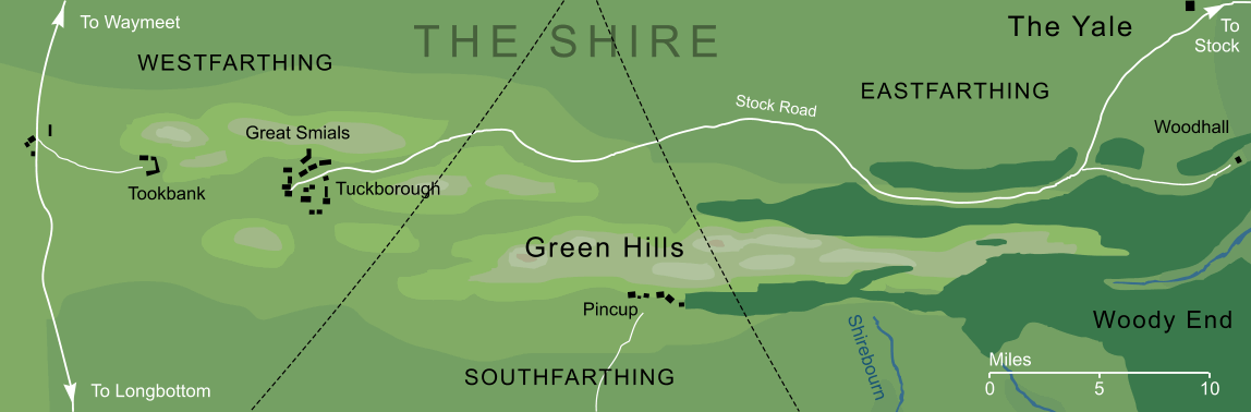
The range of hills that ran west-to-east through the Shire, through three of the Shire's four farthings, that gave its name to the region known as the Green Hill Country. To the west, in the Tookland, the hills were fairly open and treeless. In contrast, their eastern slopes towards Woody End were densely wooded with trees of all kinds.
At least three rivers and streams had their sources among the Green Hills: the river Shirebourn, Thistle Brook and the Stock-brook. One of the chief towns of the Shire-hobbits, Tuckborough, lay among the western hills, and other villages were to be found among their slopes, or about their feet, including Tookbank, Woodhall and Pincup.
Indexes:
About this entry:
- Updated 20 May 2012
- This entry is complete
For acknowledgements and references, see the Disclaimer & Bibliography page.
Original content © copyright Mark Fisher 2001, 2010, 2012. All rights reserved. For conditions of reuse, see the Site FAQ.