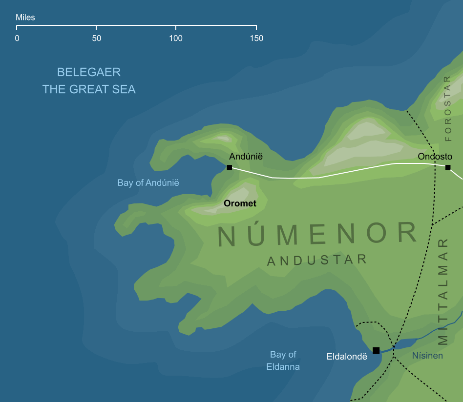
Possible location of Oromet (conjectural)2
Possible location of Oromet (conjectural)2
A hill in the Andustar region of Númenor, rising near the city of Andúnië on the western coasts. Tar-Minastir, the sixth King of Númenor, built a tower there to look out westwards over the Sea, so that he could glimpse the sails of the Eldar, and even the shores of Tol Eressëa itself in the faint distance.
Over the centuries that followed, the Númenóreans fell away from their friendship with the Eldar. Near the end of Númenor's history, King Tar-Palantir repented and turned back to the old ways, but by his time the Eldar had long since abandoned the Númenóreans. Like his ancestor Tar-Minastir, Tar-Palantir would stare out to sea from the top of the tower on Oromet, but he never saw the sail of an Elven-ship returning to Númenor, and the distant shores of the Lonely Isle were lost to sight.
Notes
1 |
The name Oromet is not explained, but a possible interpretation would be 'end mountain' or 'hill at the end'. Given that the hill rose from a promontory, this might be taken to suggest that it was at the end of that promontory. Based on Tolkien's sketch-map of Númenor, however, the hills of the Andustar did not extend onto its western headlands. Assuming that 'end mountain' is the correct interpretation (which is by no means certain), then it would seem to refer to the hill being the most westerly of the range that ran along the northern coasts of the region.
|
2 |
The precise location of Oromet is not shown on any map. All we can say with certainty, based on textual references, is that it stood close to the port of Andûnië, and that the tower on its summit looked out toward the West. The location marked here represents the highest peak near to Andûnië marked on Tolkien's sketch-map of Númenor, but its identity is not absolutely established.
If we interpret Oromet as 'end mountain', that might suggest an alternative location near the end of one of the Andustar's western promontories. This would make sense, too, in terms of Tar-Minastir's tower looking out to the West. The sketch-map of Númenor, however, shows no hills or mountains on these promontories.
It should also be noted that the location shown for the city of Ondosto here is also speculative and, like that for Oromet, is based on a textual description rather than being shown directly on a canonical map.
|
Indexes:
About this entry:
- Updated 26 July 2024
- This entry is complete
For acknowledgements and references, see the Disclaimer & Bibliography page.
Original content © copyright Mark Fisher 2006, 2023-2024. All rights reserved. For conditions of reuse, see the Site FAQ.