Somewhat conjectural1
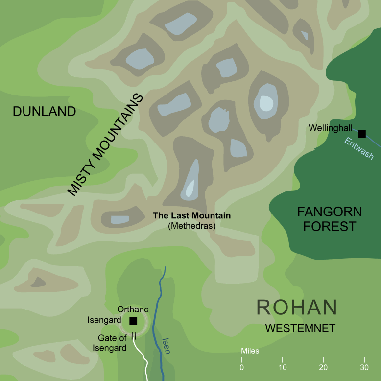
The name given to the southernmost of the true mountains in the range known as the Misty Mountains. Its snow-capped peak rose westward of the southern parts of Fangorn Forest, and the sources of the river Entwash rose from beneath the trees of its foothills.
The name 'Last Mountain' translates the Elvish name Methedras, which literally means 'last horn'. It did not mark the final southern extent of the Misty Mountains (a trail of highlands and hills continued southward for some fifty miles) but it was the last of the range that could truly be called a 'peak'.
Notes
1 |
The locations shown on the map for Wellinghall and the upper Entwash are inferred from textual references. They are not shown specifically on any canonical map and so, while they must have been in the approximate region shown, their exact positions are not known with certainty.
|
For acknowledgements and references, see the Disclaimer & Bibliography page.
Original content © copyright Mark Fisher 1997-2026. All rights reserved. For conditions of reuse, see the Site FAQ.
Quick, simple and effective, it's easy to see why DISC is such a popular profiling solution.
 SHARE
SHARE