The Forest of
Fangorn (somewhat speculative)
1
The Forest of
Fangorn (somewhat speculative)
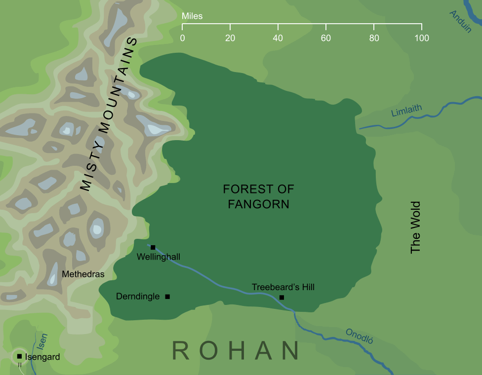
1The deep, dark woodland that grew beneath the southern Misty Mountains, on the eastern flanks of that range. Millennia before the War of the Ring, these woods had spread across the western lands of Middle-earth, but the forestry of the Númenóreans had seen them dwindle during the Second Age, and by the end of the Third, the Forest of Fangorn was the last large part of that old forest to survive, though not the only one.
The forest took its name from the Elvish Fangorn, 'Treebeard', a reference to the old Ent who dwelt there. The Ents had once walked freely in the western lands, but with the failing of the forests, their range was diminished, so that by the time of the War of the Ring, they were only found in any numbers in the Forest of Fangorn. Though they had remained hidden in the Forest for centuries at this time, they emerged to play an important part in that War, overcoming Saruman's fortress at Isengard, and helping to destroy his troops.
Notes
1 |
Some of the locations shown on this map are derived from textual descriptions, and in certain cases these present some difficulties. In particular, we're told that Wellinghall was in the foothills of the Misty Mountains, but also that it lay about sixty miles from Treebeard's Hill on the edge of the forest. Following the scale of the original map, the forest was approximately one hundred miles across, so it is hard to reconcile these comments. We might perhaps imagine that the rocky foothills of the mountains extended for some considerable distance beneath the trees, which would help to account for this apparent discrepancy. Alternatively, Treebeard's Hill may have stood somewhat further westward than shown here (though this seems less likely, given that it is established as being near the point where the river Onodló or Entwash flowed out of the forest). |
Indexes:
About this entry:
- Updated 3 June 2022
- This entry is complete
For acknowledgements and references, see the Disclaimer & Bibliography page.
Original content © copyright Mark Fisher 2003, 2022. All rights reserved. For conditions of reuse, see the Site FAQ.
Website services kindly sponsored by Axiom Discovery aptitude and skill testing.
Personality is one part of understanding a candidate's suitability for a role, but aptitude can also be crucial.