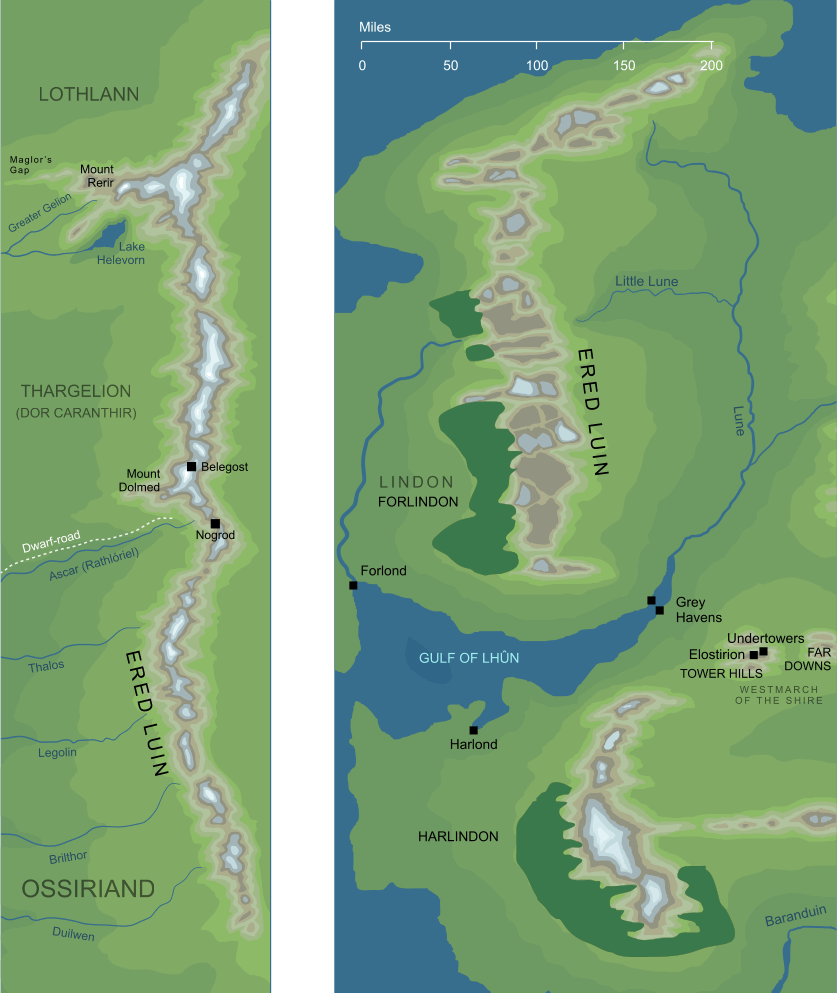
The map on the left shows Ered Luin, the
Blue Mountains, during the
First Age, before the cataclysm that brought that
Age to its end. The map on the right shows the later geography of the mountains, specifically in the early years of the
Fourth Age.
The map on the left shows Ered Luin, the
Blue Mountains, during the
First Age, before the cataclysm that brought that
Age to its end. The map on the right shows the later geography of the mountains, specifically in the early years of the
Fourth Age.
"...and they climbed the heights of Ered Luin and looked eastward in wonder, for wild and wide it seemed to them were the lands of
Middle-earth."
Quenta Silmarillion 13,
Of the Return of the Noldor
The Elves' name for the Blue Mountains, the broken range that separated Lindon in the west from Eriador in the east.
See also...
Ambaróna, Balin, Blue Mountains, Dwarves of the Blue Mountains, Dwarves of the Lonely Mountain, East End, Elu Thingol, Ered Engrin, Ered Lindon, Green-elves, Hadhodrond, Laiquendi, Lake Helevorn, Longbeards, Men of Eriador, [See the full list...]Mount Dolmed, Mountains of Lune, River Brilthor, River Duilwen, River Lune, Seven Rivers of Ossir, Sindar of Beleriand, Talath Rhúnen, The Accursed, Western Mountains
Indexes:
About this entry:
- Updated 28 April 2014
- Updates planned: 1
For acknowledgements and references, see the Disclaimer & Bibliography page.
Original content © copyright Mark Fisher 1998, 2001, 2014. All rights reserved. For conditions of reuse, see the Site FAQ.
Website services kindly sponsored by Axiom Discovery aptitude and skill testing.
Axiom Discovery gives you comprehensive online aptitude testing covering core skills across a wide range of disciplines.